Kayaking Ogunquit River – Ogunquit, ME

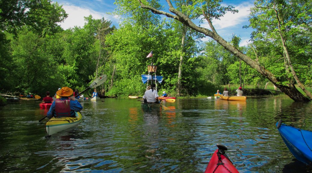
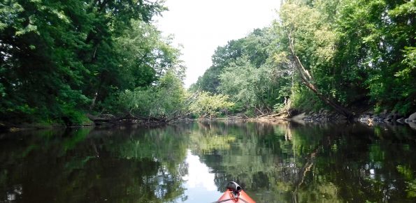
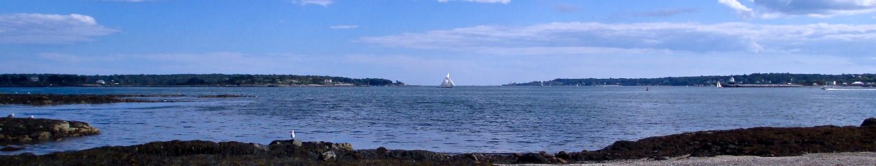
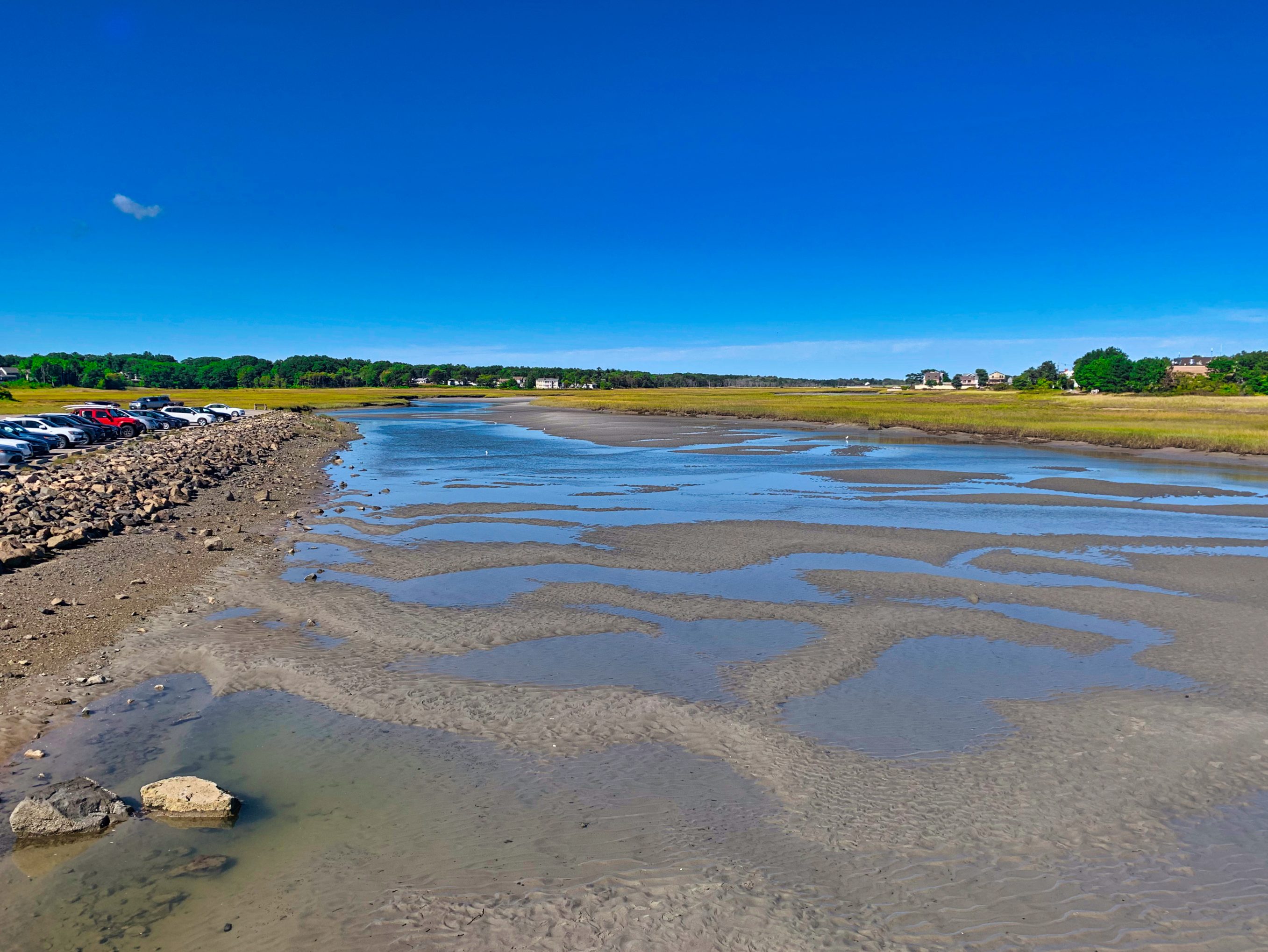
The Ogunquit River in Ogunquit, ME is a shallow tidal river popular with kayakers, paddleboarders and tubers alike.  On any summer weekend you’ll see many different types of crafts paddling this sweet little river.

Because the Ogunquit River is so shallow,  it can only be paddled for a couple of hours either side of the high tide which limits your time on the water making this a rather short kayaking trip.  However, the real draw to the Ogunquit River is its fantastic location directly behind Ogunquit’s famous Foot Bridge Beach, considered one of the best stretches of beach on the Gulf of Maine.

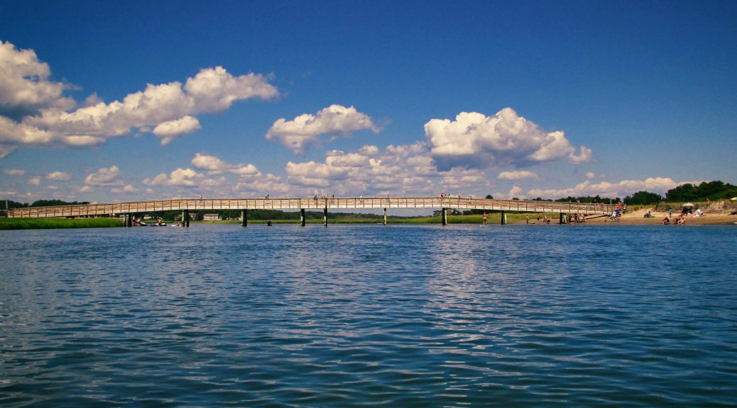
Kayakers can enjoy both the river and the beach on the same day without the need to move their car.  After you finish kayaking, grab your beach gear and simply walk across the pedestrian bridge and enjoy the rest of the day at the beach. This easy access to Foot Bridge Beach makes kayaking the Ogunquit River worth the effort.  We highly recommend this outing, especially with kids.  A fun little river to kayak and a great beach make for a perfect family day in the sun.

WHY PADDLE HERE? –  For a combination kayak and beach day,  family fun, scenic beauty, coastal nature, tidal river experience, or a sunset paddle.

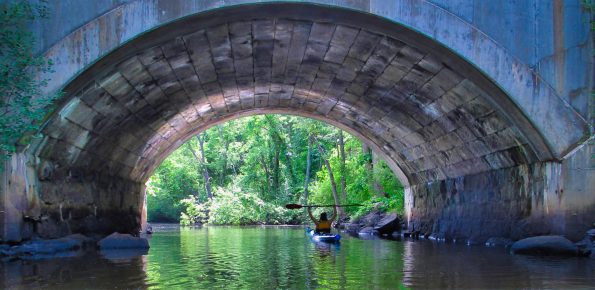
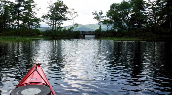
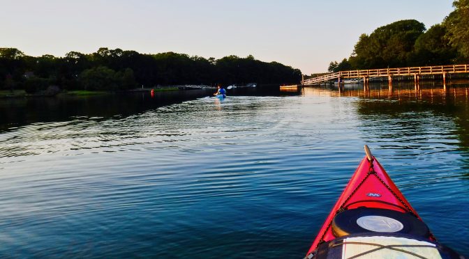
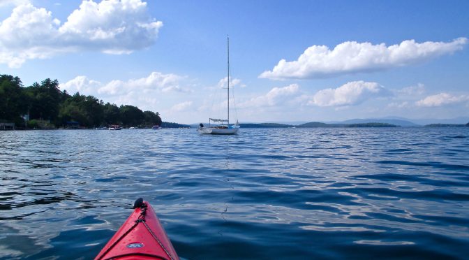
THE PADDLING ROUTE – We launched from the Foot Bridge Beach boat ramp located at the eastern end of Ocean St. in Ogunquit, ME and turned left, paddling upriver exploring the marshy river until the river narrowed.  We then reversed course and paddled downriver with the outgoing tide. We paddled past our launch point and continued down-river paddling under the Beach St. bridge to the Ogunquit Main Beach area where the Ogunquit River meets the Gulf of Maine.

In the main beach area, we paddled around for a little bit and then began to paddle back upriver, fighting against the strong current of the outgoing tide.  Once we paddled back under, and away from, the Beach St. Bridge, the worst paddling was over as the current significantly slackened. It was only 15 minutes past high tide and the current was already quite strong.

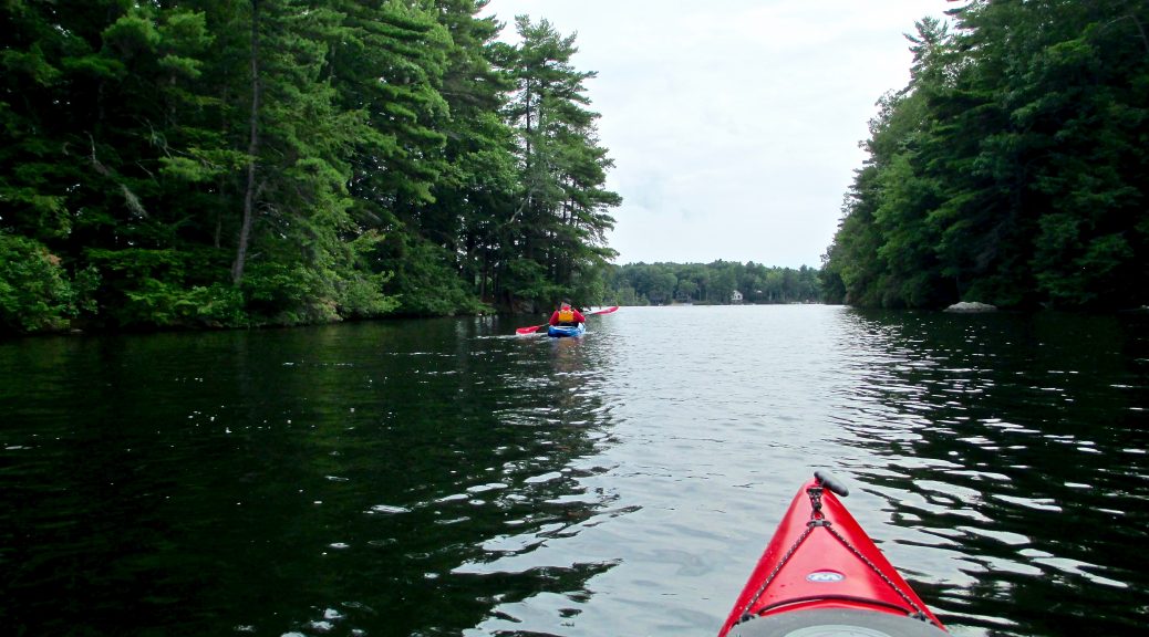
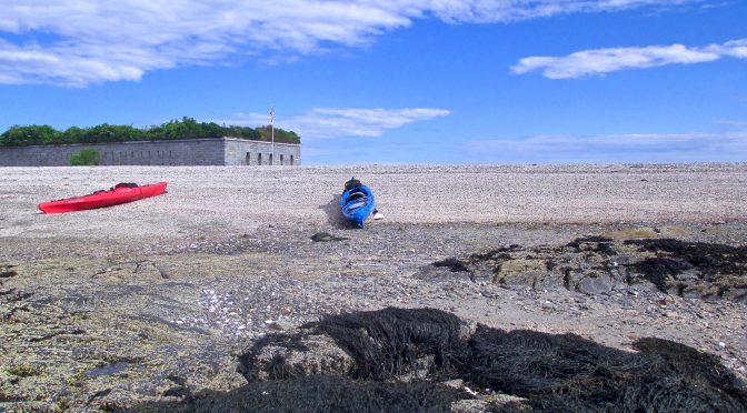
We continued paddling upriver and took a break on the side of the river along the way. There are plenty of places to stop and at least one spot with direct beach access.

After our break, we paddled back to the launch site, loaded up our kayaks and gear, then hit the beach for the rest of the day.  This is  definitely a shorter kayaking trip but still very enjoyable.

Keep track of the tide or you might end up stranded!

CAUTIONS- Watch the tides!  Kayaking on Ogunquit River is only accessible close to high tide, launch 2 hrs. before and return 2 hrs. after high tide if you want to play it safe.  Also, there are strong currents near the main beach where the river and ocean converge.  Avoid paddling under the Beach St. bridge with young or novice  paddlers as they may have trouble paddling against the currents in this area.   

PARKING & LAUNCH – A large parking lot with boat ramp is managed by the town of Ogunquit, ME at Foot Bridge Beach parking lot located at the East end of Ocean St. in Ogunquit, ME.  There is room for kayak trailers, unload your kayaks at the boat ramp and park in the rear of the lot.  There is a $25 fee to park and launch, $50 if you bring a kayak trailer.  They do accept debit/credit cards.

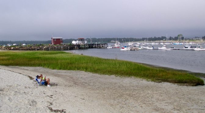
RESTROOMS – Yes! Public restrooms are located across the river from the boat launch at the opposite end of the Foot Bridge Beach pedestrian bridge.

WHEN TO VISIT – For kayaking, launch 2 hrs. before high tide and return within 2-3 hrs after high tide.  After kayaking, load your boats on your car and then walk across the Foot Bridge Beach pedestrian bridge and enjoy some time on the beach.  Avoid weekends if you can, especially holiday weekends.  Although the parking lot is large, it fills up fast.  An early morning high tide is your best bet to secure a parking spot for the day during busy summer weekends.

DIRECTIONS

TIDE CHART

WORLD WITHIN KAYAK RENTALS


Kayaking Pepperell Cove – Kittery, ME

Pepperrell Cove in Kittery, ME is one of several premier kayaking destinations for paddlers in southern Maine.  Pepperrell Cove’s beautiful views, central location and all-tide boat ramp make it easy for paddlers of all experience levels to launch a kayak and enjoy a day on the water.

Located near the Atlantic Ocean on the Maine side of the mighty Piscatacqua River, Pepperrell Cove’s location lends itself to several paddling trips of varying lengths.

Depending on one’s experience and skill level, a kayaker may opt to paddle in the cove or venture down Chauncey Creek to Brave Boat Harbor.  Other paddlers may choose a trip down the Piscataqua River and over to Little Harbor and some may choose to travel up the Piscataqua River to Spruce Creek or other locales.  Several worth while trips originate from Pepperrell Cove making this a very popular launch site for kayakers in southern Maine.

WHY PADDLE HERE? – For harbor views, scenic beauty, coastal nature, a tidal water experience, or a combination paddle/beach day.


THE PADDLING ROUTE – We launched 1.5 hrs. before low tide and paddled across Pepperrell Cove then headed east along the northern side of the Piscatacqua River to access the beach area just west of Fort Foster.  We ate lunch on the beach and then paddled in the waters adjacent to Fort Foster before returning to spend more time on the beach.  We then reversed course paddling with the incoming tide back to the boat ramp.

CAUTIONS- Tides, waves, fog, rapidly changing weather conditions and frequent large boat traffic. 

PARKING & LAUNCH – The town of Kittery, ME maintains a working pier with an all-tide boat ramp located at the end of Bellamy Lane. There are approximately ten free parking spots available to the public at the pier. The rest of the parking spots are either resident parking or limited to one hour.  There is a $5 launch fee per kayak.  Pay envelopes are located at the top of the boat ramp.  The Harbormaster’s office is located at the pier and both the Harbormaster and the local police are frequently on-site at the pier.

RESTROOMS – Yes! There is a singular public bathroom located at the end of the Harbormaster’s office building.

WHEN TO VISIT – Avoid busy summer weekends and holidays if you can as public parking is limited at the boat ramp.  Paddle 2 hrs. either side of high tide for the easiest paddling.  If you love spending time on the beach, launch 2-3 hrs. before low tide for the best access to the beaches and return at least 1 hr. after low tide.

TIDE CHART Click Here

US HARBORS LINK Click Here

PEPPERRELL COVE FOOD OPTIONS – Click Here

DIRECTIONS Click Here – 

2019 Sagamore Creek Cleanup Day

May 31, 2019       9:00 AM to 12:00 PM

Attention all kayakers! Join the effort to help keep our coastal shores clean for local wildlife and paddling enthusiasts alike. Bring your kayak or stand-up paddle board to Portsmouth Kayak Adventures on May 31, 2019 and participate in cleaning up the shores of the beautiful Sagamore Creek.

Volunteers should plan to meet and launch their boats at Portsmouth Kayak Adventures. Depending on how many volunteers sign up, paddlers may be divided into several groups to collect trash all along the creek.

REGISTER: Sign-up for the event through NatureGroupie.org. Updates and/or cancellation will be posted at “Save the Great Bay – Piscataqua Estuary” Facebook page.

WHAT TO BRING: Volunteers are encouraged to bring their own kayaks or SUPs, but a limited number of boats will be available from Portsmouth Kayak Adventures. Please bring your own gloves and paddling safety equipment (PFDs). Bug repellant is suggested. Snacks and water will be provided.

QUESTIONS? Contact Melissa Paly at mpaly@clf.org or call 603-502-0798.

NATURE GROUPIE –  Click Here

SOCIETY FOR THE PROTECTION OF NH FORESTS  – Click Here

PORTSMOUTH KAYAK ADVENTURES – Click Here 

GOOGLE DIRECTIONS– Click Here


Kayaking To Choate Island – Essex River Basin – Essex, MA

The Essex River Basin in Essex, MA is home to the Crane Wildlife Refuge. Encompassing seven islands, the refuge is surrounded by the Essex and Castle Neck Rivers and the Great Marsh. Choate Island, the largest of the islands, is a popular kayaking and day hiking destination boasting extraordinary views from its elevation overlooking the river basin and beyond. For little effort, one can easily hike to the height of the land via mown grass trails courtesy of the MA Trustees of Reservations who manage the island and maintain its three historic buildings. Choate Island was originally the summer home of the native Agawam people and more recently, the set of the 1995 movie The Crucible.

WHY PADDLE HERE? –  To explore a tidal river basin, hike Choate Island, relax on a sandbar, for coastal scenic beauty or a  combination kayaking-hiking-beach day.

THE PADDLING ROUTE – For this trip we left the planning to others and joined a guided kayak tour to Choate Island arranged by Essex River Basin Adventures (ERBA) of Essex, MA.

Today’s launch site was the public boat launch located at 138 Conomo Point Road in Essex, MA.  Once on the water, our ERBA tour group of fourteen paddlers immediately turned left, and paddled behind, and then along the left side of, Corn Island.  We then paddled the Choate Island Channel aside the Great East Sand Bar continuing on until reaching the back side of Crane Beach where our group enjoyed some time in the sun and a swim.

After our beach break, we re-launched and paddled over to Choate Island where we landed and hiked on well-worn grass paths to the historic Choate family farm-house still standing since c.1725.  We gathered around the back of the original two-story home and enjoyed a picnic lunch in the shade of the old building.  But, what’s a hike to a historic location without a little local knowledge? Lucky for us, Tom Barrieau of the MA Trustees of Reservations was paddling with our group today and provided a brief history lesson of the island and its early inhabitants.

After our lesson, we continued hiking toward the top of the island while gazing at the magnificent views of the river basin below.  The views along the hike were our reward for the physical effort it took to reach this unique location and we couldn’t help but feel grateful for the opportunity to witness such natural beauty on this warm September afternoon.

Once arriving at the height of the land, we located the final resting place of Cornelius and Mine Crane, the last stop on our journey.  We pondered the views from the hilltop before retracing our steps to the water’s edge and then paddled back to Conomo Point Road landing at Clammer’s Beach.

The impressive views of the Essex River Basin from the trails on  Choate Island, combined with a history lesson, and some time spent on the beach, made this paddle a local adventure to remember and one that we highly recommend.

CAUTIONS- Tides, shifting sand bars, boat traffic and rapidly changing winds and weather conditions.  Attention to the tides is critical as the river basin’s numerous sand bars can leave an unprepared kayaker stranded.

Conomo-Point-Rd-Boat-Launch-Essex-MA
Conomo Point Rd. Boat Launch – Near Low Tide

PARKING & LAUNCH – Because the town of Essex, MA has little to no non-resident public parking spaces at each of its three public launch areas, I would recommend skipping the hassle of trying to find  parking and enlist the services of a local kayak shop.  Essex River Basin Adventures (ERBA) 1 Main St. Essex, MA, is a fully outfitted kayak shop and tour operation offering both kayak rentals and several interesting guided tours.

RESTROOMS – NO.  There are no restrooms available at any of the public launch sites in Essex nor anywhere else while kayaking the Essex River basin, so plan accordingly.

WHEN TO VISIT – Plan to visit during the milder days of June, September or October if your primary reason to paddle the basin is to hike Choate Island.  Otherwise, paddle here during the summer  and spend some time relaxing on a sandbar or the back side of Crane Beach.  Avoid the summer weekend crowds if you can.

TIDE CHART – Click Here

US HARBORS LINK – Click Here

ESSEX RIVER BASIN ADVENTURES – 2020 Update- No longer in business. 

MA TRUSTEES OF RESERVATIONS – Click Here

MA TRUSTEES OF RESERVATIONS KAYAK TRIPS – Click Here

ESSEX MA HARBOR MASTER – Click Here

138 CONOMO POINT RD. LAUNCH (NORTH END) Click Here 

CONOMO POINT RD. LAUNCH (CLAMMER’S BEACH) – Click Here

MAIN ST.  BOAT LAUNCH Click Here

2018 Paddle-A-Thon Topsfield, MA

On Saturday, June 16, 2018 the Ipswich River Watershed Association held their 3rd annual paddling event at the Topsfield Fairgrounds to benefit the beautiful, but endangered, Ipswich River.

More than 130 paddling enthusiasts gathered for a day of fun to support efforts to protect the Ipswich River and its wildlife.

A 4-mile morning group paddle, followed by lunch, live music and an afternoon canal race kept all the guests busy and entertained while raising funds and awareness for the river.

It was our first time paddling the Ipswich River, and our first time paddling this year, and what a day it turned out to be.  Sunny skies and perfect temperatures made for a leisurely day exploring the river, making new friends and paddling for a worthy cause.

The folks at the Ipswich River Watershed Association work hard at promoting the ecological and recreational value of the Ipswich River and we applaud their dedication and continuing commitment to the health of the river.

We encourage all paddlers to learn more about the Ipswich River Watershed Association and hopefully join them in protecting this valuable local river, its tributary streams and its estuary.

Ipswich-River-Paddle-A-Thon
Be a champion for the river!

We certainly plan on paddling the Ipswich River estuary this year and hope to learn more about these local waters and the recreational opportunities they provide.

Have you paddled the Ipswich River estuary?

To learn more about the Ipswich River and several of its paddling routes please refer to the links below.

Ipswich River Watershed AssociationClick Here

Middleton  Stream TeamClick Here


Kayaking the Lower Merrimack River – A Free Presentation – June 7, 2018

Have you always wanted to kayak the tidal areas of the lower Merrimack River but lack the confidence to do so?  Do you long to explore the creeks and salt marshes of the Parker River National Wildlife Refuge but question whether you have the necessary skills required to paddle these tricky waters?

Well you’re not alone, but all that is about to change.  Attend a free presentation that will boost your knowledge, increase your confidence and provide an opportunity to meet other kayakers interested in paddling this scenic tidal area.

Parker-River-Wildlife-Refuge-At-Dusk
Parker River Wildlife Refuge at dusk

The Merrimack River Watershed Council is offering  a free program, Kayaking the Lower Merrimack River, presented by Ken Taylor, the owner of Plum Island Kayak.  Ken is a highly regarded, highly experienced kayaker who will teach you tips and tricks designed to help you safely paddle the lower Merrimack River area.

This free program will be presented Thursday, June 7 at 6:30 p.m. at the Parker River National Wildlife Refuge headquarters, Plum Island Turnpike, Newburyport., MA.  No reservations required.

PARKER RIVER NATIONAL WILDLIFE REFUGE Click Here

DIRECTIONS Click Here


Kayaking Chocorua Lake – Tamworth, NH

The beautiful views of Mt. Chocorua, clear water, and the fact motors are not allowed here, are the top reasons to kayak Chocorua Lake and its adjoining neighbor, Little Lake.  At only 222 acres, Chocorua Lake is small and shallow but its views are large, reason enough to paddle here.

Although Rte. 16 traffic can often be heard from the lake, once you paddle out into the middle, or over to the western side of the lake, you’ll feel like your paddling a much more secluded body of water.

If you love mountain views as much as I do, its a fantastic place to paddle for a couple of hours, or longer, if you decide to have lunch and swim.

WHY PADDLE HERE?For mountain scenery, exercise, relaxation, family fun or a fall foliage paddle.

THE PADDLING ROUTE – We launched into Chocorua Lake from one of the several access spots adjacent to the parking area.  Once on the water, we couldn’t resist immediately paddling to the center of the lake to take in the wonderful views of Mt. Chocorua and its surrounding peaks.

We paddled across the lake, along the westerly shore and under the bridge into Little Lake.  We paddled around Little Lake for a while and then back under the bridge returning to Chocorua Lake.  We paddled along Chocorua’s eastern shore and then back to the middle one last time before landing back where we launched.

CAUTIONS! – Winds and rapidly changing weather.  Also, be careful of the bees when paddling near the pickerelweed in adjoining Little Lake.

PARKING & LAUNCH – Chocorua Lake Conservancy owns and maintains the public access to Chocorua Lake located on the east side of the lake along Old Route 16 where you will find parking and several areas to access the lake.  There are more parking and access areas on the southern end of the lake near the bridge to Little Lake.  Watch the signage to avoid parking in the Tamworth residents only section.

RESTROOMS- Yes, there are portable toilets located at both parking areas.

WHEN TO VISIT- Anytime during spring, summer or fall is a great time to paddle here.  Parking spaces are more prevalent during early morning or late afternoon hours.

NH FISH AND GAME MAP – Click Here –

DIRECTIONS – Click Here –

Kayaking Contoocook River- Concord, NH

This section of the Contoocook River running from Contoocook Village, NH to the Contoocook Canoe Co. in Concord, NH is a 9 mile journey along a tree-lined river replete with fallen trees and limbs to avoid.  If you’re lucky, you may see some wildlife, Canada Geese, Blue Heron, turtles and eagles are occasionally spotted here. The high river banks and feeling of seclusion will make you forget you’re so close to the city.

WHY PADDLE HERE?  For a leisurely 9 mile paddle on a tree-lined river, a shorter family paddle to Daisy Beach or a fall foliage paddle.

THE PADDLING ROUTE – We rented a tandem kayak from the Contoocook Canoe Co.  9 Horse Hill Rd. Concord, NH opting for their 9 mi./14.5 km. one way trip.  What a value at only $30 for 2 paddlers and 1 tandem kayak, including transportation.  After the usual safety briefing, we were shuttled upriver to the Contoocook Village kayak launch by a very helpful employee who carried our kayak down the short, but steep, embankment to the river launch site.

Once launching, our group began paddling downriver and within a couple of minutes, we encountered what would be the first of many fallen trees and branches congesting the river.

We continued paddling downriver taking our time, always on the lookout to avoid the next sunken tree or limb.

After paddling several miles, we were ready to pull over and stretch our legs, but most of the river is tree-lined, with high banks and few places to pull over.  The few decent spots we did eye, were already filled with other kayakers and we were forced to continue paddling until reaching Daisy Beach at the 7 mi./11.2 km. mark.

Thank goodness for Daisy Beach,  a welcome relief after a long paddle without a break.  By the time we arrived, we were more than ready to ditch the kayak and eat lunch sitting in our comfortable camp chairs, yes, that’s right, camp chairs.  I can’t emphasize enough how much of a difference having chairs can make during a long paddling trip, or any paddling trip, especially as you age.

Excluding the Wilderness Girls paddlers, I’ve never seen any other paddlers bring chairs with them and I often wonder why.  Which would you rather sit on, the ground, your kayak or a perfectly comfortable chair?  Call me a wooss if you like, but I’ll always choose a chair over sitting on the ground.

Stow one in your kayak hatch, or under the bungee cords on your deck if you can, but always bring a chair, it really does make a difference.

We rested and ate lunch at Daisy Beach, which I would describe as a  sweet little riverfront swimming hole. It has a couple of picnic tables and a rope swing.  The rope swing appears to be popular among the locals and provided entertainment for the rest of us.

We finished our lunch and re-launched for the final leg of the trip, an easy 2 mi./3.2 km. paddle bringing us directly back to the Contoocook Canoe Co.’s own riverfront launch site.  The staff awaits your arrival, they’re eager to help you exit your kayak and carry your personal belongings back to your car for you.  Bring cash to tip the staff, they deserve it.

The only wildlife we saw during this trip was a flock of Canada Geese on the side of the river as we silently paddled by.

I’m not sure how I feel about this trip, 7 miles is just too long for me to paddle without a guaranteed place to break.  I most likely won’t ever paddle here again, but on the off-chance I do, it will be during fall foliage and I will launch directly from the canoe company’s own put-in, enabling me to paddle upriver to Daisy Beach and beyond, paddling only as far as I choose to go.

In my opinion, the lower section of this trip is much more enjoyable to paddle with fewer obstacles to avoid, but there is a trade-off, unlike the upper section, it has less nature and some development, which personally, I don’t mind.  Every paddler has different likes and dislikes, so you’ll just have to judge this trip for yourself.

CAUTIONS!  Watch out for the numerous fallen trees, branches, rocks and debris at, or just below, the waterline.  In the busy season, be prepared to paddle almost the entire trip without a break as you may not be able to find an unoccupied space to land before reaching Daisy Beach, at the 7mi./11.2km. mark. 

PARKING & LAUNCH There is plenty of parking at the Contoocook River Canoe Co. where we rented a tandem kayak for this trip.  We took a shuttle to the launch site at Contoocook Village where you’ll find signage and a path leading down a short, but steep, embankment to the launch.

RESTROOMS  NO. There are portable toilets at the Contoocook River Canoe Co. but they are too disgusting to use.  Visit the Dunkin Donut shop, 98 Fisherville Rd. (Rte 3 near Bog Rd.)  prior to arrival.

WHEN TO VISIT – Visit during summer if you are paddling with children to swim at Daisy Beach.  Opt for a shorter trip by launching directly from the Contoocook Canoe Co.’s own launch and paddling 2 mi./3.2 km. upriver to Daisy Beach and as far beyond as you wish.  Otherwise, a fall foliage paddle is the best time to paddle this section of the river.

Skip this trip entirely if you have to travel any distance to get here, there are just too many better waterways in NH to paddle than this section of the Contoocook River.

DIRECTIONS – Click Here.

CONTOOCOOK CANOE CO.  – Click Here.

Kayaking Conway Lake – Center Conway, NH

WHY PADDLE HERE?For mountain scenery, exercise, relaxation, family fun or a fall foliage paddle.

THE PADDLING ROUTE  Today’s paddling goal was to enter the main body of water to enjoy the mountain views and paddle along the eastern shoreline.  The boat launch is located at the end of a finger and to enter the main body of the lake you must paddle out of the finger.  Once leaving the boat launch, paddle straight bypassing an additional finger located on the left not far from the launch.  Continued paddling following the shoreline.  As the course turns right paddle along the left shoreline.  Shortly, you will see mountains in the distance and you will be entering the main area of the lake.  Turn left to paddle along the eastern shoreline.  Conway Lake is large with many coves, fingers and islands to explore however the lake is heavily developed and the islands are privately owned.  Due to its size, Conway Lake is best paddled in multiple trips.  There is an additional boat launch located on the southern end of the lake in Eaton, NH.

Kayaking-Conway-Lake
Rocks and trees

CAUTIONS!  Watch out for rocks and fallen trees at and below the waterline.  Boat traffic can be heavy especially on summer weekends and holidays.  Winds and rapidly changing weather conditions can be a challenge.   As with any large body of water, I don’t recommend paddling here on windy days.

LAUNCH & PARKING – The Town of Conway, NH maintains a public boat launch located on Mill St. in Center Conway, NH.   A parking lot for vehicles and trailers is located diagonally across the street from the boat launch.  The boat launch itself is small and has room for only one trailer or vehicle at a time.  Access to the ramp is located at the edge of the street and street traffic must stop when vehicles with trailers start to back down the ramp.  On weekends and holidays you may find vehicles, with or without trailers, lined up on the side of the roadway waiting their turn to back down the street to the boat ramp.  Do not bring you kayak trailer here if you are not completely comfortable backing without a turnaround area.  There is no fee to park or launch.    2021 UPDATE – THE PARKING LOT IS NOW PERMITED PARKING FOR CONWAY RESIDENTS ONLY.  NON-RESIDENTS CAN DROP THEIR KAYAKS AT THE PUBLIC LAUNCH THEN PARK IN THE  PINE TREE ELEMENTARY SCHOOL PARKING LOT LOCATED  ABOUT 0.4 MILES FROM THE LAUNCH. 

RESTROOMS  YES, there are portable toilets located in the parking lot across the street from the boat launch.

WHEN TO VISIT –  Avoid weekends and holidays if you can.  As with any tourist area, the parking lot fills up fast and there will be a waiting line to access the boat launch area.  A fall foliage paddle on Conway Lake is particularly beautiful with its mountain views.

NH FISH & GAME MAP – Click Here.

DIRECTIONS – Click Here.

PINE TREE ELEMENTARY SCHOOL PARKINGClick Here.

Kayaking Pawtuckaway Lake – Fundy Cove Launch – Nottingham, NH

Fundy Cove is located on the northern end of Pawtuckaway Lake where you’ll find little to no development compared to the southern end of the lake which is heavily developed and home to the ever popular Pawtuckaway State Park.  Fundy Cove and the northern end of the lake are generally considered the quieter sections with plenty of coves to explore, and a few islands to paddle around.  The northern end is popular for fishing, so even though its quieter, you won’t be alone on weekends during the summer season.

WHY PADDLE HERE? – For a less developed shoreline, fishing, exercise, relaxation or a fall foliage paddle.

THE PADDLING ROUTE – Considering we have paddled this lake many times and today’s goal was to get a bit of exercise, we opted to paddle all the way to the southern end of the lake instead of just paddling the northern end.  Once launching, we paddled out into Fundy Cove and then followed the shoreline passing Log Cabin Island and continuing south till reaching the main beach area at Pawtuckaway State Park.  After a break, we paddled around Horse Island and then paddled north returning to Fundy Cove.  It’s approximately a 3mi/4.8km paddle from Fundy Cove to the main beach area.

CAUTIONS! Watch out for rocks at and just below the waterline.  Motor boat traffic can be heavy on summer weekends and holidays.  As with any large body of water don’t paddle here on windy days.  If it’s breezy, you are better off paddling the southern end of the lake, launching instead from Neil’s Cove in Pawtuckaway State Park.   

LAUNCH & PARKING – The town of Nottingham, NH maintains a public boat launch with a circular driveway and parking lot at Fundy Cove located at the northern end of Pawtuckaway Lake.  There is a lake host present at the launch to inspect boats and kayaks for invasive plant species.  There is no fee to park or launch.

RESTROOMS – YES. There is an outhouse facility at the boat launch. Additional restroom/changing facilities are located at the opposite end of the lake at the main beach of Pawtuckaway State Park.

WHEN TO VISIT – Avoid holiday weekends if you can.  Late afternoon paddlers experience less boat traffic.  After Labor day, the lake is very quiet and a fall foliage paddle here is pleasant.

NH FISH & GAME LAKE MAP  Click Here.

DIRECTIONS – Click Here.


Sharing The Joy Of Paddling